


5 Ten Mile Voting District, Meigs County, Tennessee
About
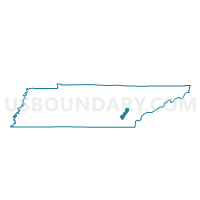
Outline

Summary
| Unique Area Identifier | 669248 |
| Name | 5 Ten Mile Voting District |
| County | Meigs County |
| State | Tennessee |
| Area (square miles) | 49.28 |
| Land Area (square miles) | 41.93 |
| Water Area (square miles) | 7.34 |
| % of Land Area | 85.10 |
| % of Water Area | 14.90 |
| Latitude of the Internal Point | 35.68569460 |
| Longtitude of the Internal Point | -84.67793370 |
Maps


Graphs
Select a template below for downloading or customizing gragh for 5 Ten Mile Voting District, Meigs County, Tennessee


Neighbors
Neighoring Voting District (by Name) Neighboring Voting District on the Map
- 08 Niota School Voting District, McMinn County, TN
- 1-2 St. Clair Voting District, Rhea County, TN
- 3-1 Wolf Creek Voting District, Rhea County, TN
- 4 Meigs North Voting District, Meigs County, TN
- Glen Alice Voting District, Roane County, TN
- Johnson School House Voting District, Roane County, TN
- Midway Voting District, Roane County, TN
- Renfro Voting District, Roane County, TN
Top 10 Neighboring County Subdivision (by Population) Neighboring County Subdivision on the Map
- District 2, McMinn County, TN (11,398)
- District 1, Roane County, TN (10,669)
- District 7, Roane County, TN (7,326)
- District 1, Rhea County, TN (3,322)
- District 3, Rhea County, TN (3,234)
- District 4, Meigs County, TN (2,074)
- District 5, Meigs County, TN (1,969)
Top 10 Neighboring Unified School District (by Population) Neighboring Unified School District on the Map
- Roane County School District, TN (51,122)
- McMinn County School District, TN (35,318)
- Rhea County School District, TN (24,618)
- Meigs County School District, TN (11,753)
Top 10 Neighboring State Legislative District Lower Chamber (by Population) Neighboring State Legislative District Lower Chamber on the Map
- State House District 31, TN (66,108)
- State House District 22, TN (64,839)
- State House District 23, TN (64,022)
- State House District 32, TN (62,448)
Top 10 Neighboring State Legislative District Upper Chamber (by Population) Neighboring State Legislative District Upper Chamber on the Map
Top 10 Neighboring 111th Congressional District (by Population) Neighboring 111th Congressional District on the Map
- Congressional District 2, TN (723,798)
- Congressional District 3, TN (692,346)
- Congressional District 4, TN (688,008)
Top 10 Neighboring Census Tract (by Population) Neighboring Census Tract on the Map
- Census Tract 9701.01, McMinn County, TN (6,976)
- Census Tract 303, Roane County, TN (6,623)
- Census Tract 304, Roane County, TN (6,559)
- Census Tract 9750, Rhea County, TN (4,829)
- Census Tract 9751, Rhea County, TN (4,594)
- Census Tract 9601, Meigs County, TN (3,155)
Top 10 Neighboring 5-Digit ZIP Code Tabulation Area (by Population) Neighboring 5-Digit ZIP Code Tabulation Area on the Map
- 37854, TN (13,108)
- 37381, TN (8,855)
- 37322, TN (8,239)
- 37846, TN (5,030)
- 37826, TN (4,361)
- 37880, TN (3,477)